A Gridded Dataset on Densities, Real Estate Prices, Transport, and Land Use inside 192 Worldwide Urban Areas
Abstract
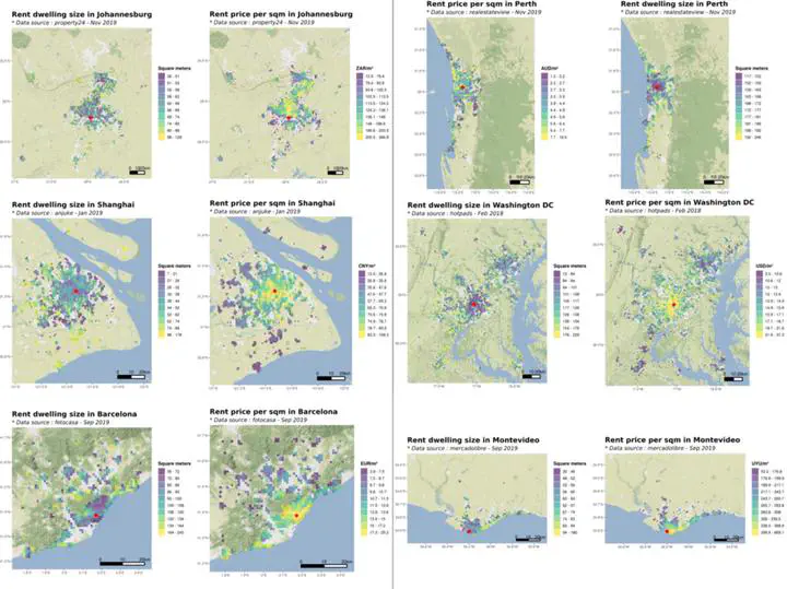
This work presents a gridded dataset on real estate and transportation in 192 worldwide urban areas, obtained from the Google Maps API and the web scraping of real estate websites. For each city of the sample, these data have been associated with the corresponding population density and land cover data, extracted from the GHS POP and ESA CCI data respectively, and aggregated on a 1km resolution grid, allowing for an integrated analysis. This dataset is the first to include spatialized real estate and transportation data in a large sample of cities covering 800 million people in both developed and developing countries. These data can be used as inputs for urban modeling purposes, transport modeling, or between-city comparisons in urban forms and transportation networks, and allow further analyses on e.g. urban sprawl, access to transportation, or equity in housing prices and access to transportation.