Are Soil Sealing Indicators Sufficient to Guide Urban Planning? Insights from an ES Assessment in the Paris Metropolitan Area
Abstract
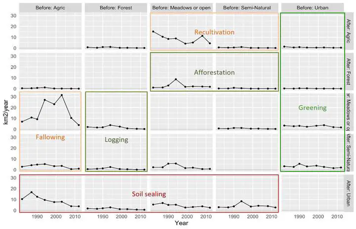
Urban sprawl impacts are critical in the evaluation of planning decisions and often monitored by indicators of soil sealing. In France, these indicators are required by law to be reported in environmental assessments of planning documents. Although monitoring of soil sealing is important to limit environmental impacts, focusing on this sole dimension in urban planning can be reductive. In this paper, we explore to what extent ecosystem services (ES) indicators, measuring the benefits to humans provided by healthy ecosystems, are captured by soil sealing indicators by comparing their temporal and spatial evolutions. Through consulting with urban planning stakeholders, we model and map the spatial and temporal evolutions over a 35-year period of soil sealing and eight priority ES in the Paris metropolitan area (agricultural potential, groundwater recharge, global climate regulation, water quality regulation through nutrient retention, urban heat mitigation, flood mitigation, recreational potential and natural heritage). We highlight the spatial and temporal matches and mismatches between the two types of indicators (ES and soil sealing) and demonstrate that a large part of ES variations in time and space are not well captured by soil sealing indicators (spatial match with the eight ES is only found for 10% of the Paris metropolitan area). This calls for finer, ES-based, diagnosis in land use planning that could usefully illuminate the gains and losses related to land use and land management policies by taking into account the environmental and societal impacts of urban sprawl.